 Engineering geomorphological mapping
Services in detail
Remote sensing for project planning, terrain evaluation, materials prospecting and geohazard assessment
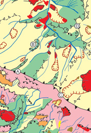
During the planning and preliminary design of most infrastructure projects it is important to ensure that as much information as possible is obtained from airborne and satellite imagery, combined with field verification. This enables large areas to be examined rapidly, and allows important topographical, geological and geohazard features, and design and construction issues, to be identified early on.
Landslide investigation and stabilisation
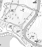
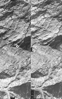
Landslides and earthworks failures can pose a significant threat to the stability and safety of
infrastructure, mining operations, urban and housing developments and other land uses. Once remotely sensed data sources have been interpreted, the next step is to employ field mapping techniques to confirm the extent, causes and mechanisms of existing and potential future slope instability. This allows the risk posed by individual landslides and slopes to be assessed and provides the basis for planning sub-surface investigations and the development of designs for earthworks and slope stabilisation measures.
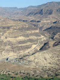
Feasibility study, design, construction and operation of roads through difficult terrain
Mountainous terrain in particular can pose major
difficulties for the construction and operation of infrastructure, especially roads. Floods, landslides and debris flows continue to cause major disruption
and damage in many areas, and poor decisionmaking over alignments and earthworks design can lead to severe operational and environmental impacts. Dr Hearn has played a pivotal role in bringing together the skills and techniques required
to develop optimum alignments and designs in a range of environments.